Case study 02 / Deeds + boundary history
Independence Park boundary history.
I am reconstructing the changing boundary of Independence Park from handwritten deeds, recorded maps, right-of-way changes, adjoining parcels, and present-day records. The goal is to show which line belongs to which moment in the park’s history.
Back to survey projects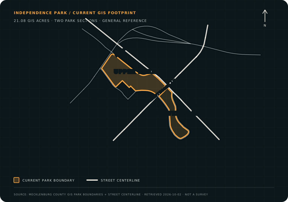
Current county GIS footprint / historical deed layers are kept separate
The question / One place, several footprints
Which boundary are we talking about?
The 1904–05 assemblage
The early park came together through several conveyances rather than one clean parent tract. I am plotting the separate deed calls and their adjoiners before combining anything.
Roads, school, stadium, and transfers
Later public uses and right-of-way projects changed how the park was described, occupied, and mapped. Those changes need their own dated layers instead of being folded into the original line.
Operational and GIS footprints
A current parcel or park-maintenance line answers a different question from a historic deed boundary. I keep those footprints separate and label the source and date for each.
Public history / A changing civic landscape
Key events around the boundary.
These events provide the historical frame for the record research. They do not replace the deeds; they explain why later lines and uses may differ.
- Charlotte begins assembling land for its first public park.The idea was advanced in March, land was conveyed in August, and the name Independence Park followed in October.
- Early surveys and additions describe a multi-tract park.Recorded descriptions, a division map, adjoining owners, streets, stakes, and Sugar Creek form the starting evidence.
- A playground adds a new programmed use.The public function starts evolving even while the land records retain their own history.
- Armory, memorial, rose garden, and stadium projects reshape the site.Each improvement adds another reason to distinguish occupied areas from record title.
- Independence Boulevard changes the park’s edge and circulation.Transportation work becomes a major boundary and right-of-way research layer.
- The 34-acre park reopens after a major renovation.The present public park is one endpoint in a much longer chain of land, use, and mapping decisions.
Survey research / Evidence before closure
How I am working the record.
Transcribe the calls, book and page references, stated areas, grantors, grantees, and exceptions into a source matrix.
Hold the written bearings and distances long enough to expose gaps, overlaps, nonclosure, and conflicting assumptions.
Compare adjoiners, historic rights-of-way, monuments, creek calls, and recorded maps before choosing how records relate.
Maintain distinct historical, regulatory, transferred, and current operational footprints, each with its own source and confidence note.
Evidence register / Core records
The early acquisition set.
| Record | Stated area | How it is used |
|---|---|---|
| Deed Book 190, pp. 411–412 | 1.75 acres | Plot independently; compare its corners and adjoiners to the 1905 division map. |
| Deed Book 190, pp. 413–414 | 5.57 acres | Track the second early tract and its relationship to the street network. |
| Deed Book 190, pp. 415–417 | 12.85 acres | Test shared calls against the neighboring conveyances before combining. |
| Deed Book 198, pp. 204–205 | 26.5 acres | Compare the largest early conveyance with creek and adjoining-property evidence. |
| Deed Book 202, pp. 197–198; map p. 326 | Three additions | Use the mapped additions to connect the deed mosaic and its 1905 context. |
Public history sources
This is a preliminary historical boundary reconstruction based on public records and research notes. It is not a field survey or a professional boundary opinion.